

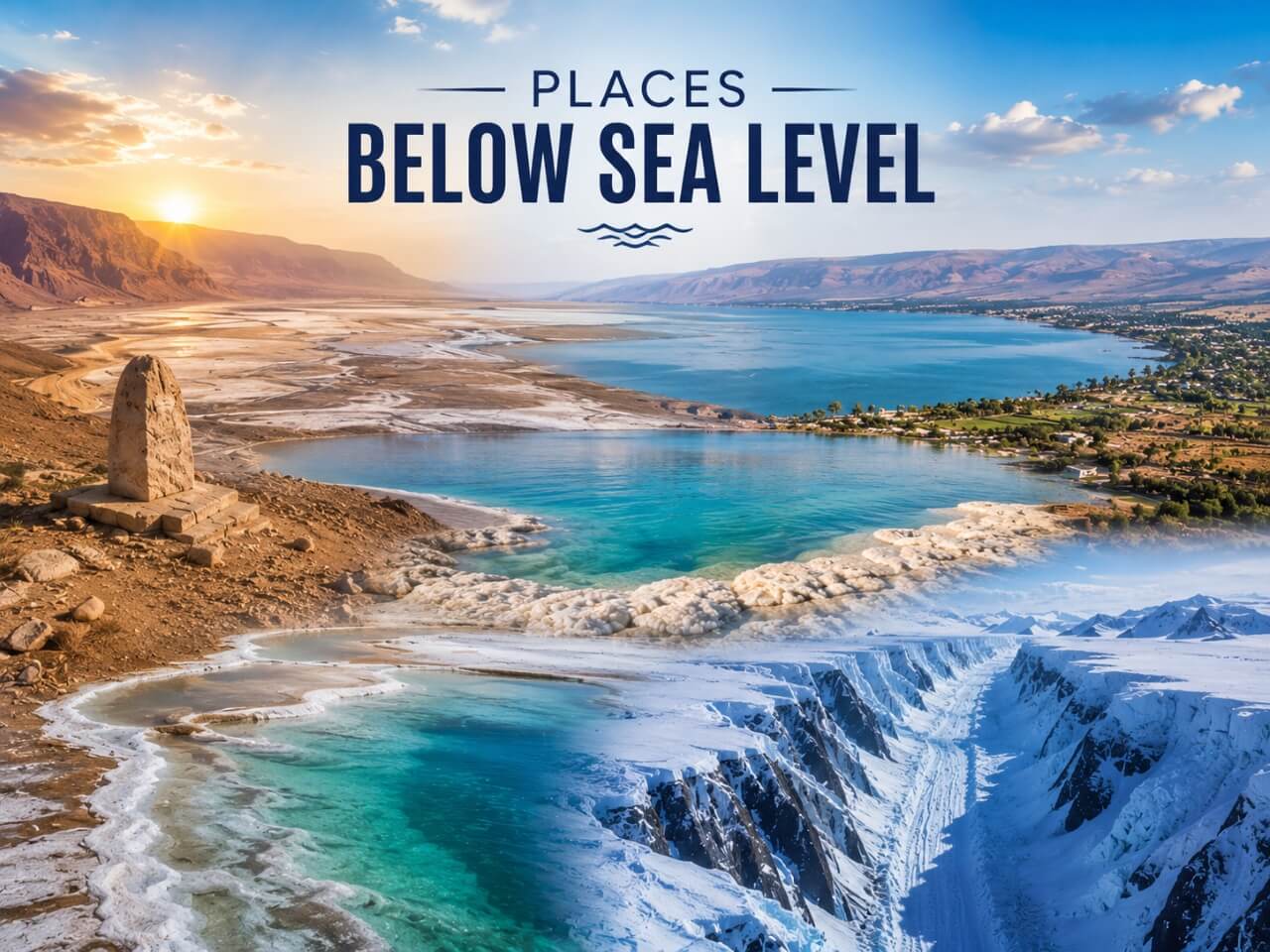
Many parts of the world lie below sea level, ranging from shallow coastal basins to dramatic natural depressions that rank among the lowest places on Earth. Some of these destinations have become famous tourist attractions known for their unique landscapes, extreme climates, and geological wonders, while others remain isolated and rarely explored. From salt flats and desert valleys to ancient lakes and hidden basins, these remarkable locations reveal a fascinating side of our planet that exists beneath the level of the sea.
Top Places Below Sea Level
Kuttanad, India
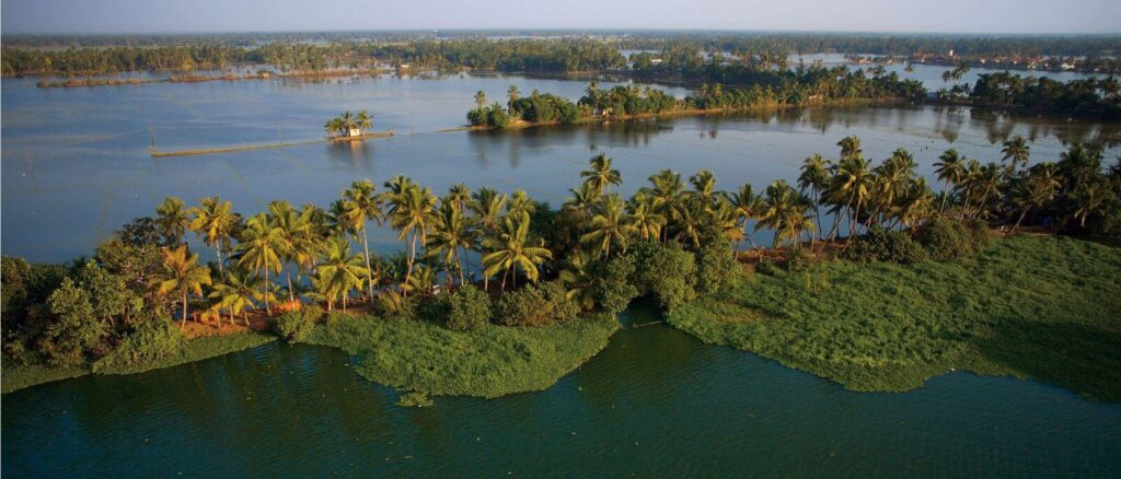
Nestled in Kerala’s scenic backwaters, Kuttanad is one of the rare places in India located below sea level, sitting approximately 7 ft (2 m) beneath it. The region is famous for its lush greenery, winding canals, and vast stretches of paddy fields that thrive across the low-lying landscape. Its distinctive geography makes it one of Kerala’s most fascinating natural and cultural destinations.
Often referred to as the “Rice Bowl of Kerala,” Kuttanad is celebrated for its unique agricultural practices. Farmers cultivate rice on reclaimed land protected by embankments and water-control systems, allowing farming to flourish despite the region’s below-sea-level elevation. Combined with serene backwaters, traditional village life, and houseboat tourism, the area offers a truly unforgettable glimpse into Kerala’s rich heritage.
Vistula Fens, Poland
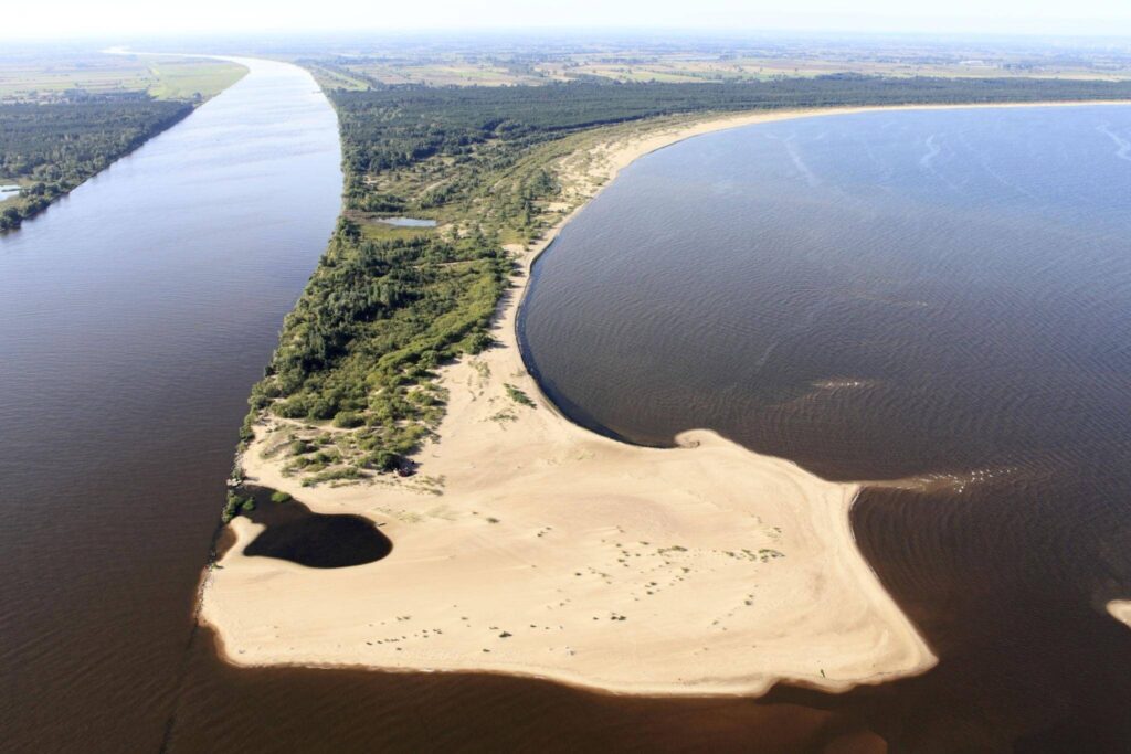
Located in northern Poland, the Vistula Fens form the fertile alluvial delta of the Vistula River, the longest river in Poland and one of the major rivers in Europe. Known locally as Żuławy Wiślane, the region is characterized by flat landscapes, canals, wetlands, and rich agricultural land shaped over centuries by river deposits and water management systems.
The area is also home to Poland’s lowest point, which lies approximately 7 ft (2 m) below sea level. Extensive dikes, drainage channels, and pumping systems help protect the low-lying terrain from flooding, making the Vistula Fens a remarkable example of how people have adapted to living and farming in a landscape below sea level.
Sebkha Tah, Morocco
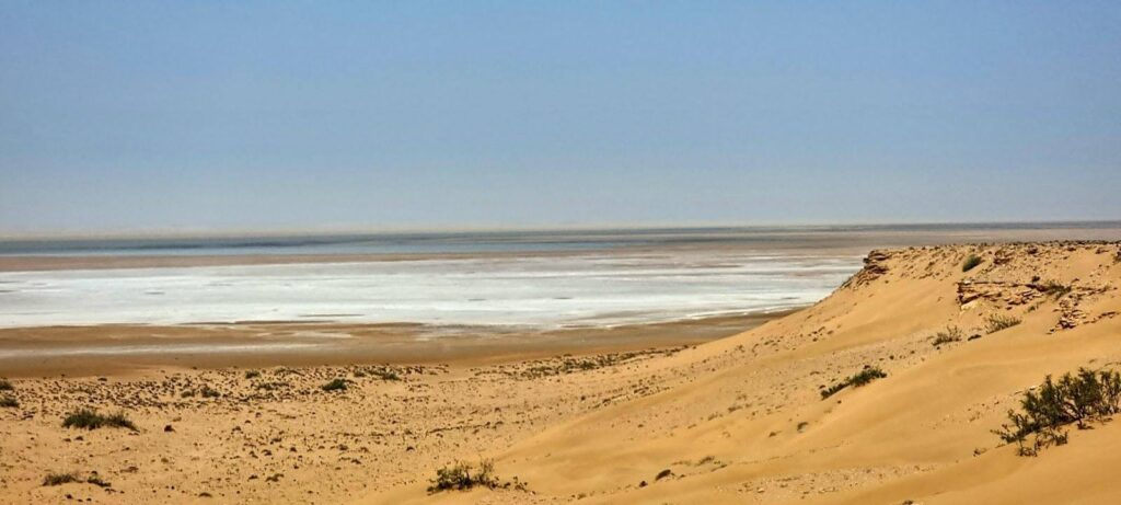
Located in southern Morocco, Sebkha Tah is a striking desert depression that reaches around 180 ft (55 m) below sea level. Surrounded by arid landscapes and rocky terrain, the area is known for its vast salt flats and dry, otherworldly scenery shaped by extreme climatic conditions. Its remote location adds to the mysterious beauty of this unique North African landscape.
A sabkha is a flat, low-lying area where salty minerals accumulate due to intense evaporation in hot and dry climates. At Sebkha Tah, layers of salt and mineral deposits create a shimmering surface that changes appearance with the light and seasons. The region stands as a fascinating example of how harsh desert environments can produce extraordinary geological formations.
Sechura Depression, Peru
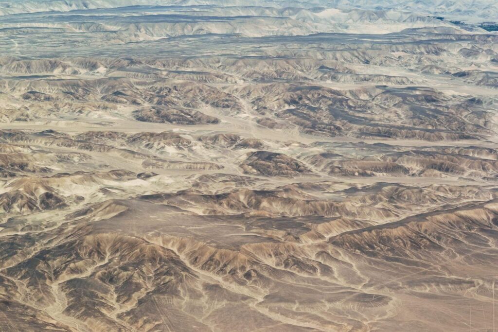
Situated in northwestern Peru, the Sechura Depression, also known as the Bayóvar Depression, is a vast lowland region within the arid Sechura Desert. The landscape is dominated by dry plains, sand-covered terrain, and sparse vegetation, creating a dramatic environment shaped by extreme desert conditions and coastal influences.
At approximately 112 ft (34 m) below sea level, the Sechura Depression marks the lowest natural point in Peru. Despite its harsh surroundings, the region holds geological and ecological significance, with nearby coastal ecosystems and mineral-rich areas contributing to its importance. Its unusual elevation and desert scenery make it one of South America’s most intriguing below-sea-level locations.
Salton Sea, United States
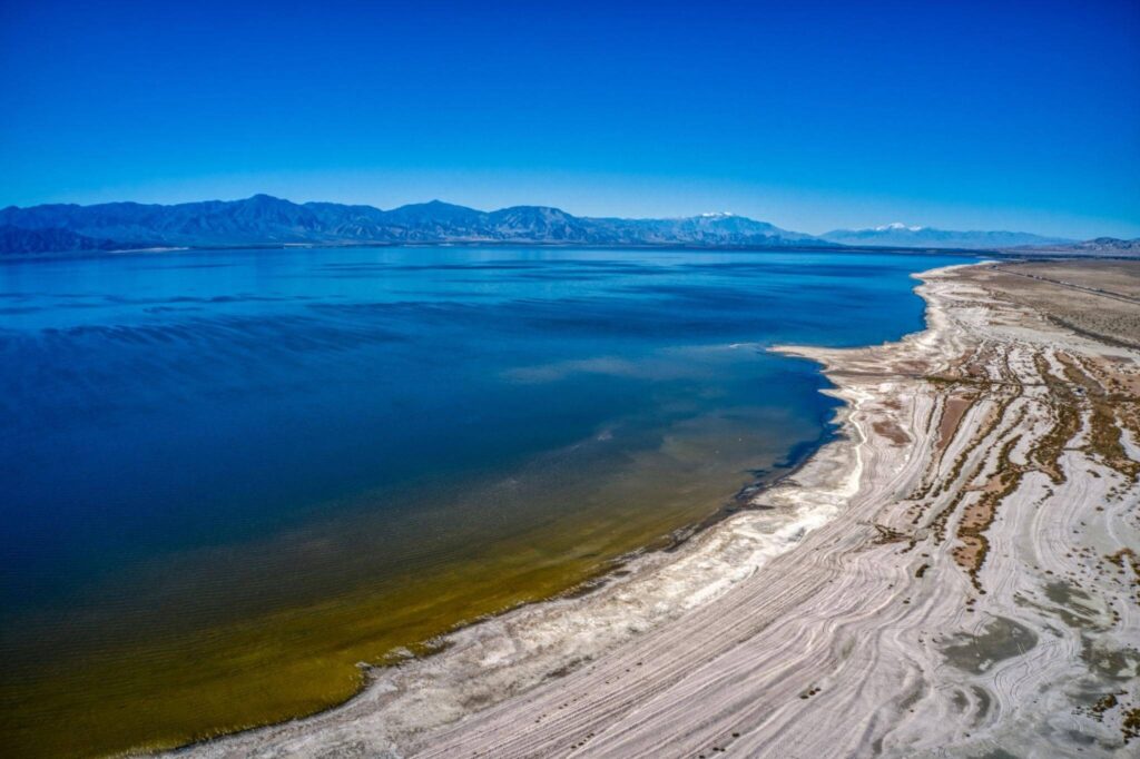
Located in southern California, the Salton Sea is a vast saline lake known for its unusual desert setting and dramatic environmental history. Surrounded by arid landscapes and rugged mountains, the lake forms one of the most distinctive geographic features in the western United States. Its waters and shoreline create a striking contrast against the harsh desert terrain.
The surface of the Salton Sea sits approximately 226 ft (69 m) below sea level, making it the second-lowest point in both the United States and North America. The lake also lies along the famous San Andreas Fault, adding geological significance to the region. Over the years, the Salton Sea has become known for its unique ecosystem, migratory bird habitats, and ongoing environmental challenges linked to rising salinity and shrinking water levels.
Zuidplaspolder, Netherlands
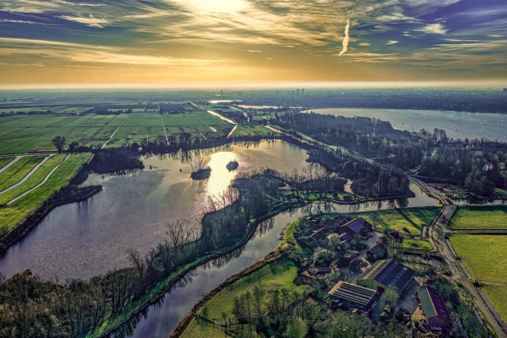
The Zuidplaspolder is a low-lying polder region in the Netherlands famous for its carefully engineered landscape of canals, dikes, and farmland. Like many Dutch polders, the area was reclaimed from water through extensive drainage and land management systems, showcasing the Netherlands’ long history of controlling and adapting to the sea.
Sitting around 23 ft (7 m) below sea level, Zuidplaspolder shares the distinction of being the lowest point in the European Union. Powerful pumping systems and flood defenses help keep the land dry and suitable for agriculture, housing, and infrastructure. The region stands as a remarkable example of Dutch water engineering and resilience against rising sea levels.
Taieri Plain, New Zealand
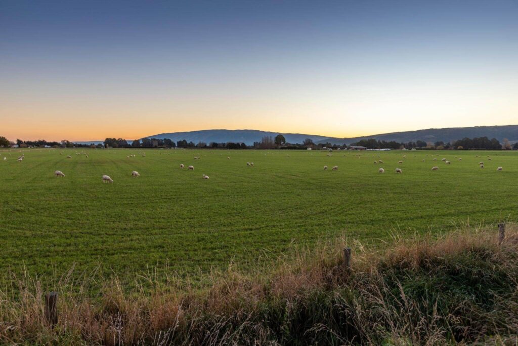
Located on New Zealand’s South Island, the Taieri Plain is a fertile lowland region known for its scenic rural landscapes and productive farmland. Surrounded by gentle hills and intersected by the Taieri River, the plain has long been an important agricultural area, supporting farming communities and livestock production across the Otago region.
The Taieri Plain also marks New Zealand’s lowest point, sitting approximately 7 ft (2 m) below sea level. Its rich soils and flat terrain make the area especially suitable for agriculture, which remains the region’s primary economic activity. The combination of natural beauty and farming heritage gives the Taieri Plain a unique place in New Zealand’s geography.
Vpadina Akchanaya, Turkmenistan
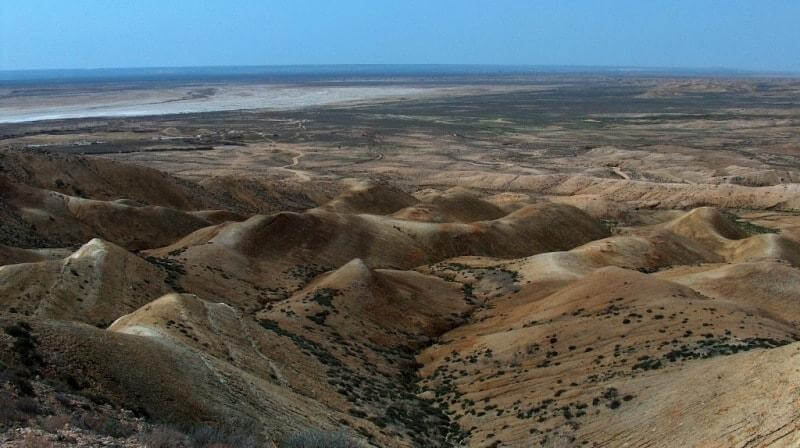
Located in northern Turkmenistan, Vpadina Akchanaya forms part of the vast Akdzhakaya Depression, a remote and sparsely populated region characterized by dry desert terrain and harsh climatic conditions. The landscape is dominated by rocky plains, salt-covered surfaces, and barren expanses that highlight the extreme environment of Central Asia’s desert interior.
At approximately 265 ft (81 m) below sea level, Vpadina Akchanaya ranks among the country’s most notable low-lying areas. Its isolated setting and unusual geography make it a fascinating natural feature, offering insight into the dramatic geological formations shaped by erosion, shifting sediments, and long-term desert processes.
Lake Qarun (Lake Moeris), Egypt
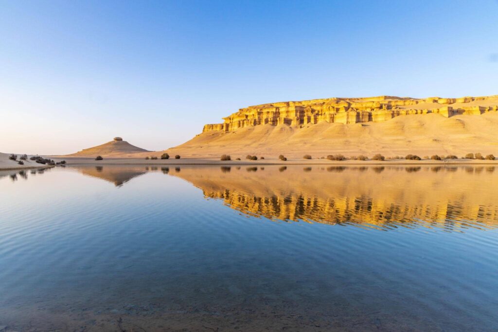
Located southwest of Cairo in Egypt’s Faiyum Oasis, Lake Qarun is one of the country’s oldest and most historically significant natural landmarks. Known in ancient times as Lake Moeris, the lake played an important role in Egypt’s early irrigation systems and agricultural development. Today, the surrounding region is admired for its desert scenery, wetlands, and rich archaeological heritage.
The surface of Lake Qarun lies approximately 141 ft (43 m) below sea level, making it one of Egypt’s notable below-sea-level locations. Although once a freshwater lake, it has gradually become more saline over time due to evaporation and reduced freshwater inflow. Despite these environmental changes, Lake Qarun remains an important ecological area that supports birdlife and tourism within the Faiyum region.
The Caspian Sea and Its Shores
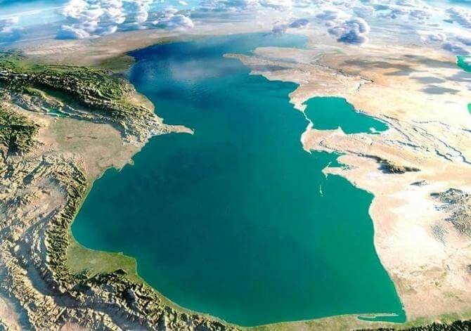
The Caspian Sea is the largest inland body of water in the world, so vast that it is often described as both a sea and a lake. Stretching between Europe and Asia, this enormous landlocked water body is bordered by Russia, Kazakhstan, Azerbaijan, Iran, and Turkmenistan. Its shores feature a diverse mix of deserts, wetlands, coastal cities, and mountain landscapes, making the region geographically and culturally unique.
In several areas, the shoreline dips approximately 92 ft (28 m) below sea level, adding to the Caspian Sea’s remarkable geological significance. The sea is also known for its rich biodiversity, major oil and gas reserves, and historic trade importance along ancient routes connecting Europe and Asia. Despite its immense size and importance, scientists have warned that changing climate conditions and declining water levels are increasingly affecting the Caspian ecosystem and surrounding coastlines.
Shatt al Gharsah, Tunisia
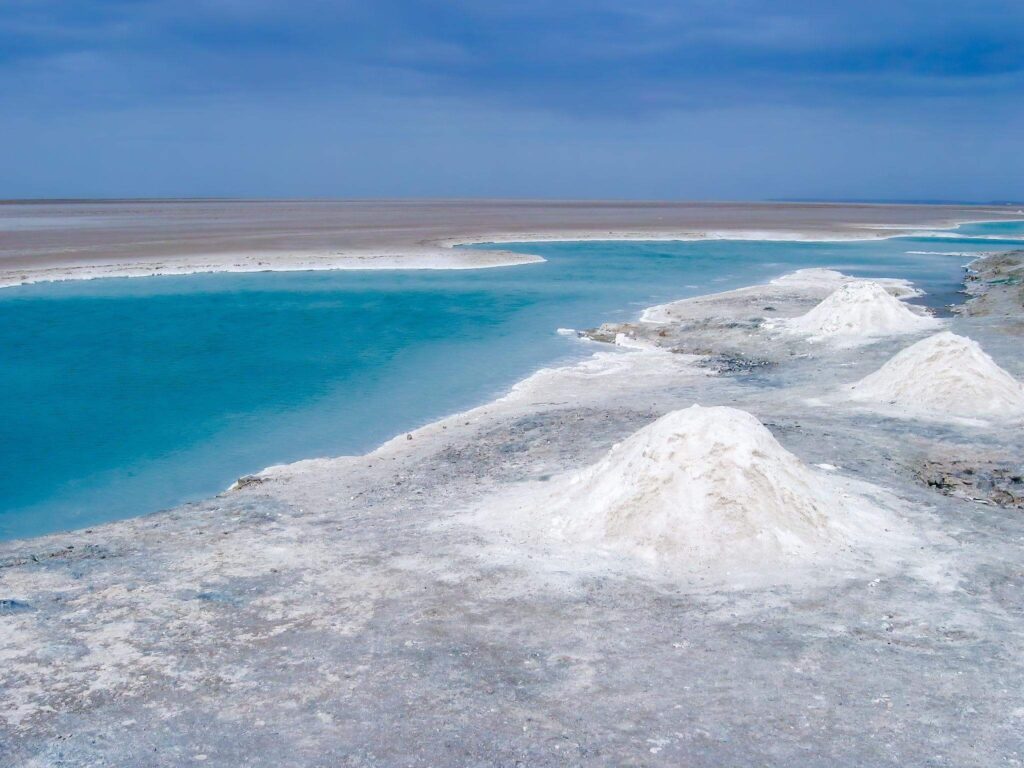
Located in Tunisia’s Tozeur region near the Algerian border, Shatt al Gharsah is a vast salt-covered depression surrounded by dramatic desert scenery. The area is part of the North African chott landscape — large dry salt lakes or plains that form in arid environments where water evaporates quickly, leaving behind thick mineral deposits and shimmering salt crusts.
At its lowest point, Shatt al Gharsah reaches approximately 56 ft (17 m) below sea level. The region’s stark beauty, intense heat, and expansive white salt flats create an almost surreal landscape that has fascinated travelers and geologists alike. Its remote setting also makes it one of Tunisia’s most distinctive natural landmarks.
Chott Melrhir, Algeria
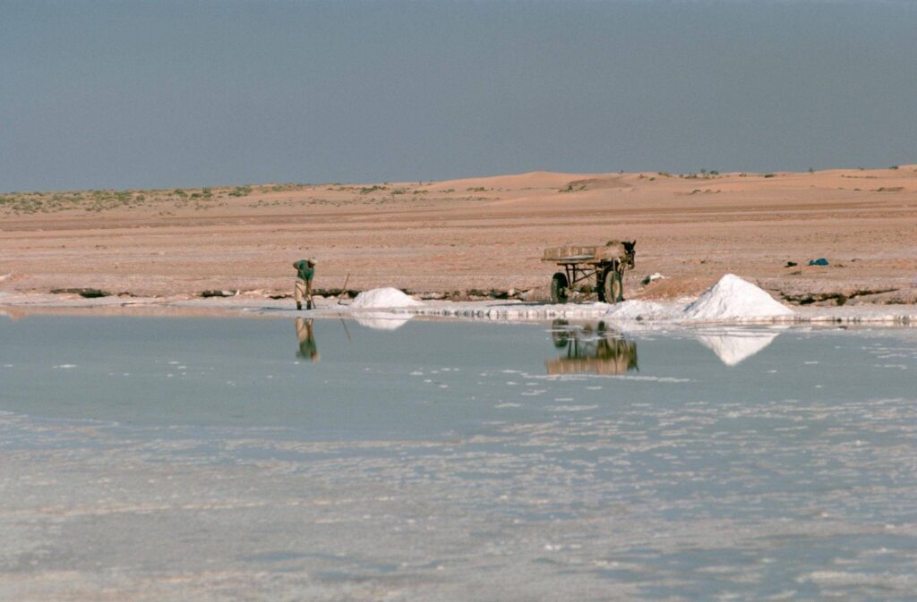
Situated in northeastern Algeria, Chott Melrhir is a vast salt lake surrounded by arid desert terrain and dramatic open landscapes. During wetter periods, shallow water covers parts of the basin, but in the intense summer heat the lake often dries out completely, transforming into a brilliant white salt pan that stretches across the horizon.
At approximately 131 ft (40 m) below sea level, Chott Melrhir is the lowest point in Algeria. The lake and its surrounding wetlands also provide seasonal habitat for migratory birds and wildlife, adding ecological importance to this otherwise harsh desert environment. Its striking scenery and extreme conditions make Chott Melrhir one of North Africa’s most remarkable natural depressions.
Lammefjorden, Denmark
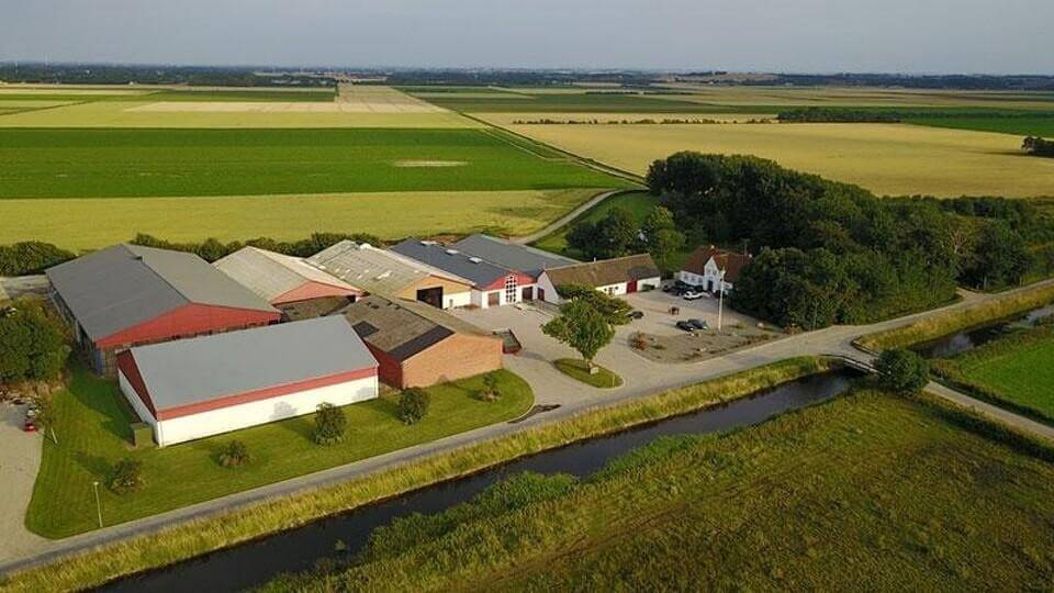
Located in northwestern Zealand, Lammefjorden is one of Denmark’s most productive agricultural regions and a notable example of reclaimed land. Originally a fjord connected to the sea, the area was gradually drained and transformed into fertile farmland through extensive engineering and water-control projects. Today, the landscape is defined by flat fields, canals, and rich soils ideal for cultivation.
Lammefjorden sits approximately 23 ft (7 m) below sea level, sharing the distinction of being among the lowest points in the European Union. The region is especially famous for its high-quality vegetables, including carrots and potatoes, which thrive in the nutrient-rich soil left behind by the former fjord. Its successful conversion from seabed to farmland highlights Denmark’s long tradition of land reclamation and agricultural innovation.
The Fens, England
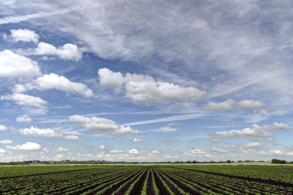
Located in eastern England, The Fens is a vast low-lying region known for its flat landscapes, fertile farmland, and extensive network of drainage channels and man-made rivers. Stretching across parts of Cambridgeshire, Lincolnshire, Norfolk, and Suffolk, the area was once dominated by marshes and wetlands before being transformed through centuries of land drainage and engineering projects.
Much of The Fens lies approximately 9 ft (3 m) below sea level, making it the lowest region in the United Kingdom. Sophisticated pumping systems, embankments, and waterways help protect the land from flooding while supporting large-scale agriculture. Today, The Fens remains one of Britain’s most important farming regions and a remarkable example of how humans have reshaped natural wetlands into productive farmland.
Vpadina Kaundy, Kazakhstan
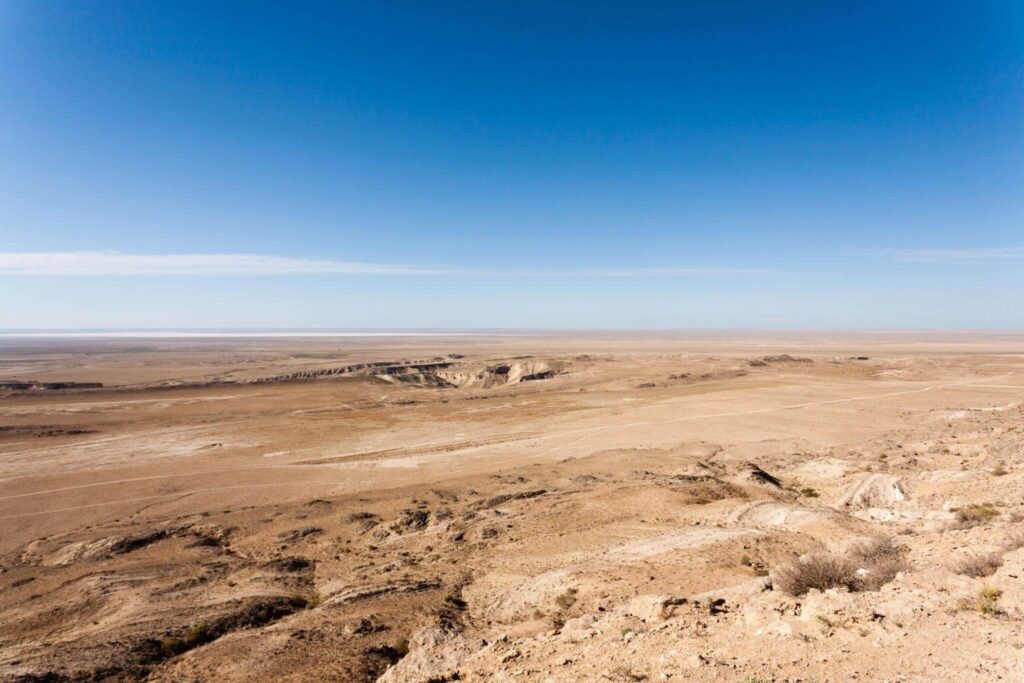
Located in western Kazakhstan near the Caspian Sea, Vpadina Kaundy marks the lowest point of the massive Karagiye Depression, one of Central Asia’s most dramatic geological formations. The region is characterized by barren desert terrain, steep escarpments, and expansive rocky plains shaped over thousands of years by erosion and underground geological activity.
The depression reaches an impressive depth of approximately 433 ft (132 m) below sea level, making it one of the deepest land depressions in the world. Often described as a giant karst trench, the area is believed to have formed through a combination of tectonic movement and the collapse of underground limestone structures. Its remote setting and unusual topography make Vpadina Kaundy one of Kazakhstan’s most fascinating natural landmarks.
Sabkhat Ghuzayyil, Libya
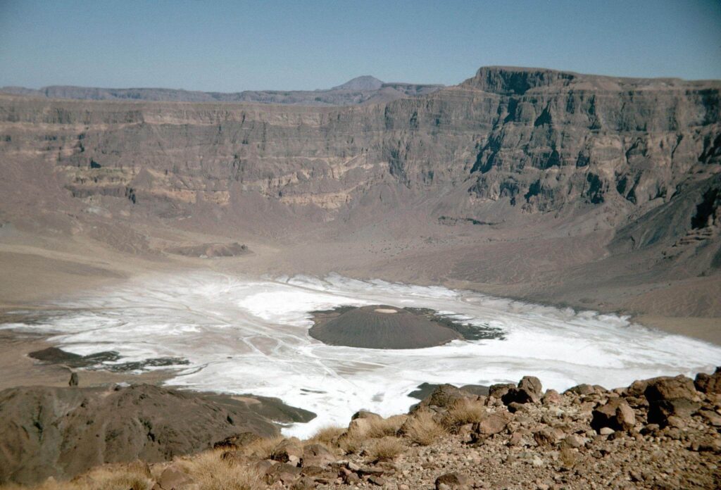
Located in the remote desert regions of Libya, Sabkhat Ghuzayyil is a vast salt flat and the lowest point in the country, lying approximately 154 ft (47 m) below sea level. The landscape is dominated by dry, barren terrain and mineral-rich surfaces shaped by intense heat and evaporation, creating a striking and isolated environment in the heart of North Africa.
Thousands of years ago, during the Holocene Wet Phase, this region was dramatically different from the arid desert seen today. Scientists believe Sabkhat Ghuzayyil was once part of a massive ancient lake system that existed when the Sahara experienced a much wetter climate. Over time, changing environmental conditions transformed the area into the salt-encrusted depression that remains today, offering valuable insight into the region’s prehistoric climate history.
Hachirōgata, Japan
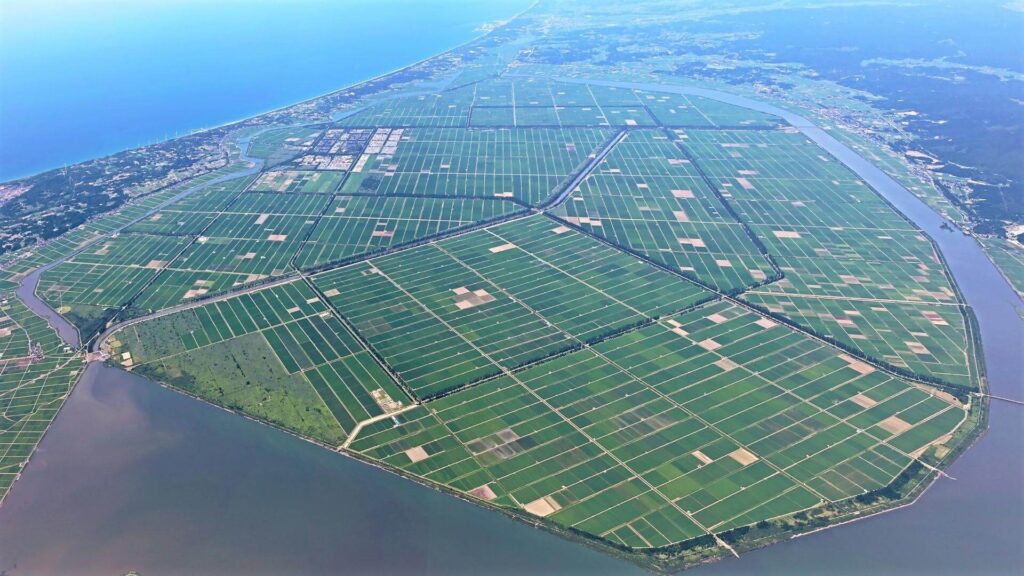
Located in Akita Prefecture in northern Japan, Hachirōgata is the country’s lowest natural point, lying approximately 13 ft (4 m) below sea level. The region is known for its wide agricultural plains and carefully managed waterways, which today form an important part of the local farming economy and rural landscape.
Much of the area was once occupied by Lake Hachirōgata, formerly one of Japan’s largest lakes. During the 1950s and 1960s, extensive land reclamation projects dramatically reduced the lake’s size, transforming large sections into productive farmland. What remains today is a much narrower body of water surrounded by reclaimed land, showcasing one of Japan’s most ambitious agricultural engineering projects.
Kuialnyk Estuary, Ukraine
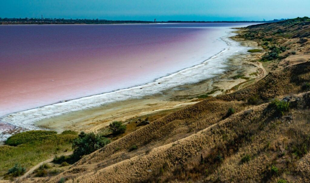
Located near the Black Sea coast in southern Ukraine, the Kuialnyk Estuary is a striking lagoon known for its mineral-rich waters, salt deposits, and therapeutic mud. The surrounding landscape features flat степpe terrain and shallow waters that create a unique natural environment valued for both its ecological and historical significance.
The area also marks the lowest point in Ukraine, sitting approximately 16 ft (5 m) below sea level. The estuary is separated from the Black Sea by a narrow peresyp, or bay-mouth sandbar, which naturally divides the lagoon from the open sea. Over the years, the Kuialnyk Estuary has become well known for health resorts and its distinctive saline ecosystem.
Lake Eyre (Kati Thanda), Australia
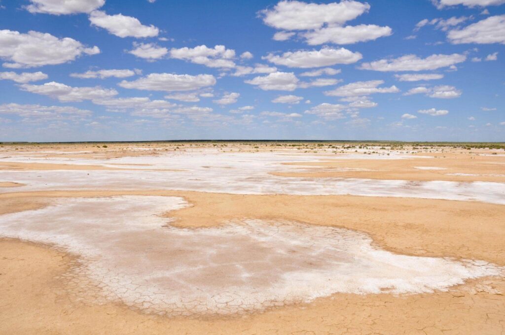
Located in the remote outback of northern South Australia, Lake Eyre, officially known as Kati Thanda–Lake Eyre, is the largest salt lake in Australia and one of the country’s most remarkable natural landmarks. The vast basin is usually dry, revealing endless white salt flats that stretch across the desert landscape, though seasonal flooding can temporarily transform it into a massive inland lake.
The lake contains the lowest natural point in Australia, reaching approximately 52 ft (16 m) below sea level. Known traditionally as Kati Thanda by the Arabana people, the area holds deep cultural significance and supports unique ecosystems when water flows into the basin. Its dramatic scenery and changing conditions make Lake Eyre one of the most extraordinary environments in the Australian outback.
Lake Enriquillo, Dominican Republic
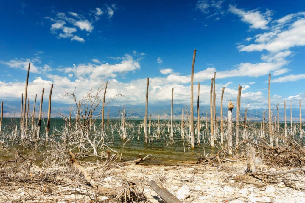
Located in the southwestern Dominican Republic, Lake Enriquillo is the largest lake in the Caribbean, as well as the largest lake on the island of Hispaniola. Surrounded by rugged mountains and dry subtropical landscapes, the lake is known for its unique ecosystem, small islands, and wildlife, including American crocodiles and flamingos that thrive in the region’s warm climate.
With a surface elevation of approximately 151 ft (46 m) below sea level, Lake Enriquillo is recognized as the lowest point of any island country in the world. The lake’s highly saline waters and isolated basin create an environment unlike anywhere else in the Caribbean, making it one of the Dominican Republic’s most fascinating natural wonders.
Death Valley, United States
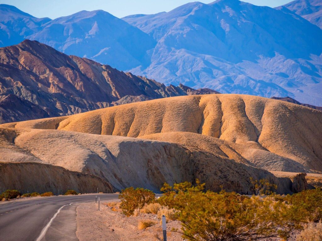
Located in eastern California, Death Valley National Park is famous for its dramatic desert landscapes, extreme temperatures, and vast salt flats. The park features rugged mountains, sand dunes, colorful canyons, and barren plains that create one of the most striking environments in North America. Its harsh climate and unique geology have made Death Valley one of the most iconic desert destinations in the world.
Within the park lies Badwater Basin, which sits approximately 282 ft (86 m) below sea level. This makes it the lowest point in North America and the second-lowest natural point in the Western Hemisphere. The basin’s bright white salt crusts and surreal scenery attract visitors from around the globe, offering an unforgettable glimpse into one of Earth’s most extreme landscapes.
Laguna del Carbón, Argentina
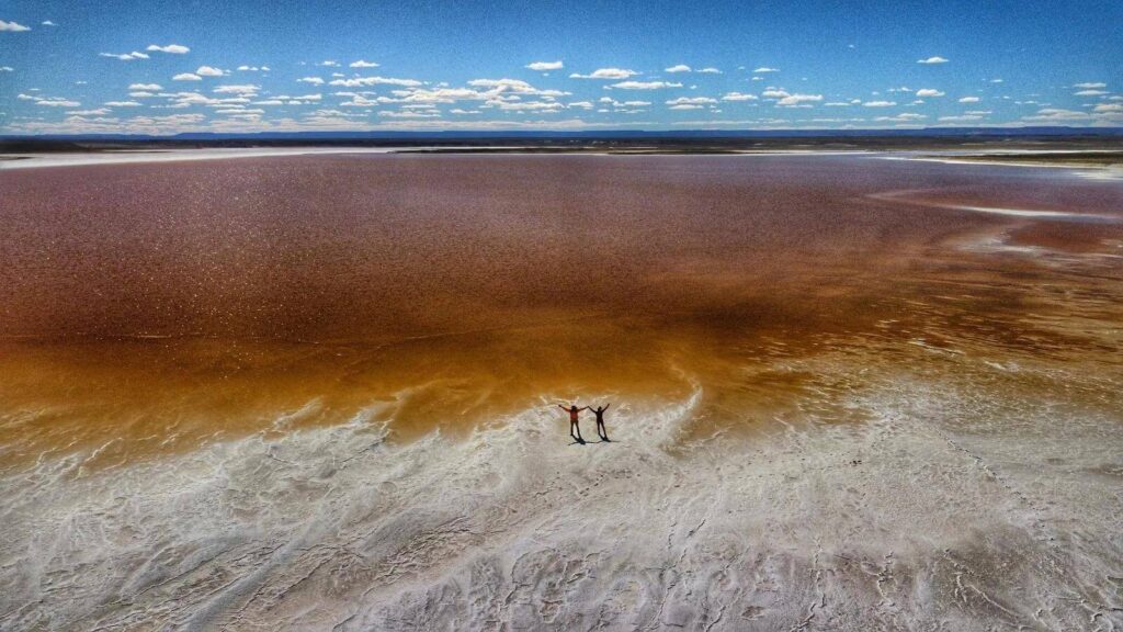
Located in Argentina’s remote Santa Cruz Province in Patagonia, Laguna del Carbón is a dramatic salt depression surrounded by dry plains and rugged southern landscapes. The area is known for its isolated beauty and stark terrain, shaped by wind, erosion, and the harsh climatic conditions typical of southern Argentina.
At approximately 344 ft (105 m) below sea level, Laguna del Carbón is the lowest point in Argentina, as well as the lowest point in both the Americas and the entire Western Hemisphere. Its extreme elevation and remote setting make it one of the most remarkable geological locations in South America, attracting travelers and researchers interested in Earth’s natural extremes.
Danakil Depression, Ethiopia
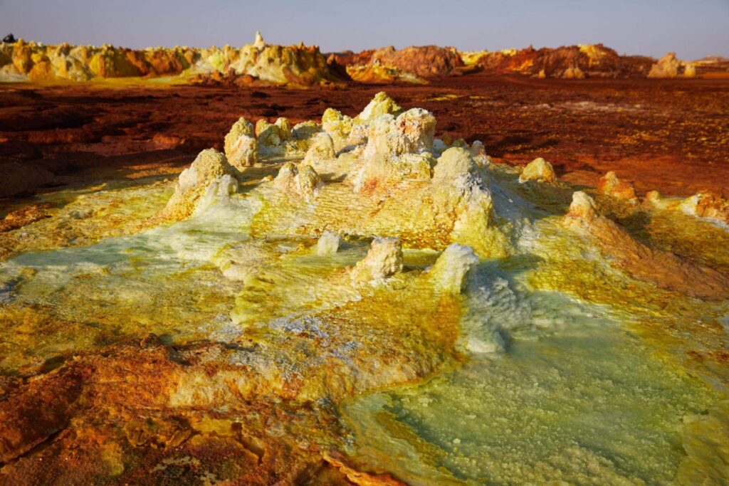
Located in northeastern Ethiopia, the Danakil Depression is widely considered one of the most extreme and inhospitable places on Earth. The region is famous for its surreal landscapes of colorful sulfur springs, salt flats, lava fields, and active volcanic zones that create an almost otherworldly environment. Constant geothermal activity and harsh desert conditions make the Danakil one of the planet’s most geologically active areas.
The depression lies approximately 410 ft (125 m) below sea level, ranking it among the lowest places on Earth. It is also one of the hottest regions in the world, with daytime temperatures frequently exceeding 122°F (50°C). Despite its unforgiving climate, the Danakil Depression remains a place of immense scientific interest and is home to traditional salt mining practices that have existed for centuries.
Qattara Depression, Egypt
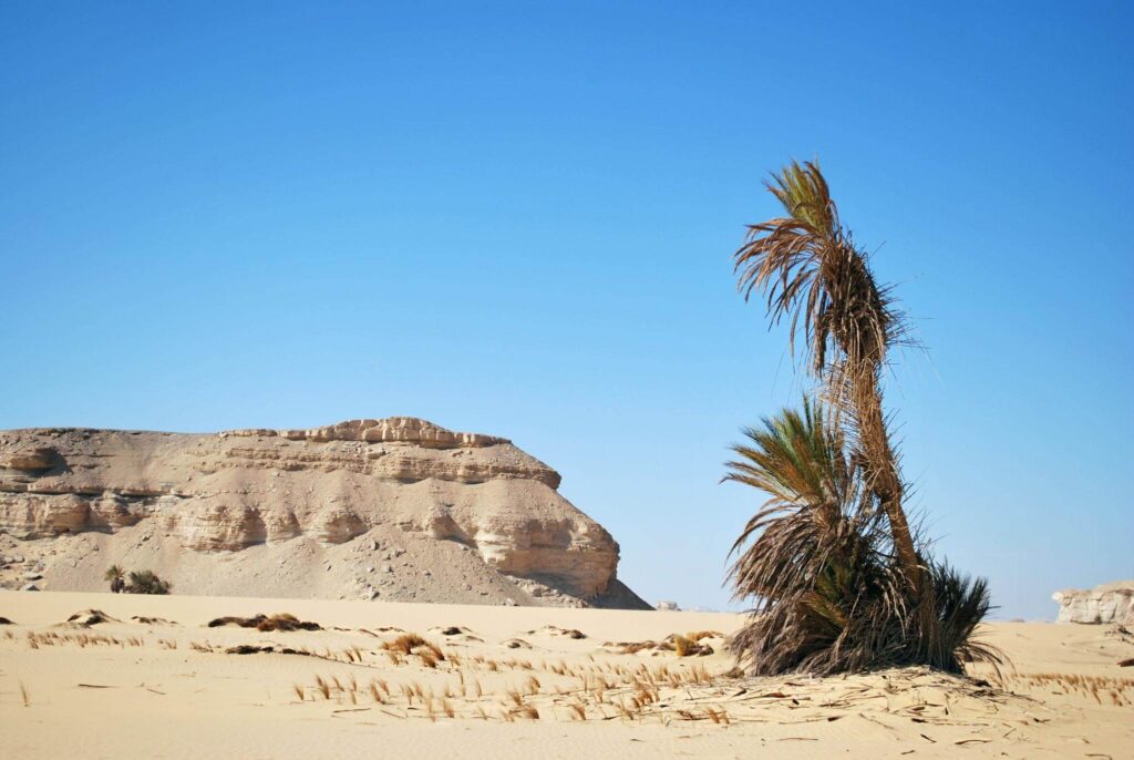
Located in Egypt’s vast Western Desert, the Qattara Depression is a massive natural basin known for its harsh desert terrain and dramatic landscapes. The region features expansive salt pans, rolling sand dunes, rocky escarpments, and salt marshes that create a striking and isolated environment deep within the Sahara.
The depression reaches approximately 436 ft (133 m) below sea level, making it the second-lowest point in Africa after Lake Assal in Djibouti. Its difficult terrain and extreme climate have kept much of the area remote and sparsely inhabited, while its unique geology continues to attract scientists, explorers, and travelers fascinated by Earth’s most extreme environments.
Turpan Depression, China
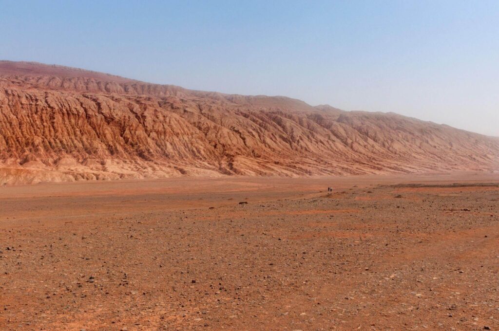
Located in China’s Xinjiang Uyghur Autonomous Region, the Turpan Depression is one of the country’s most remarkable geographical features. Surrounded by rugged mountains and arid desert terrain, the basin is known for its intense summer heat, ancient Silk Road history, and unique oasis settlements that have survived in one of the driest regions in Asia.
The depression contains the lowest point in China and the fourth-lowest terrestrial point in the world. At the site where Ayding Lake once covered the basin, the muddy and salt-covered lakebed now lies approximately 505 ft (154 m) below sea level. Marked by a stone monument, the area highlights the dramatic environmental changes that have transformed the once expansive lake into a barren desert landscape.
Lake Assal, Djibouti
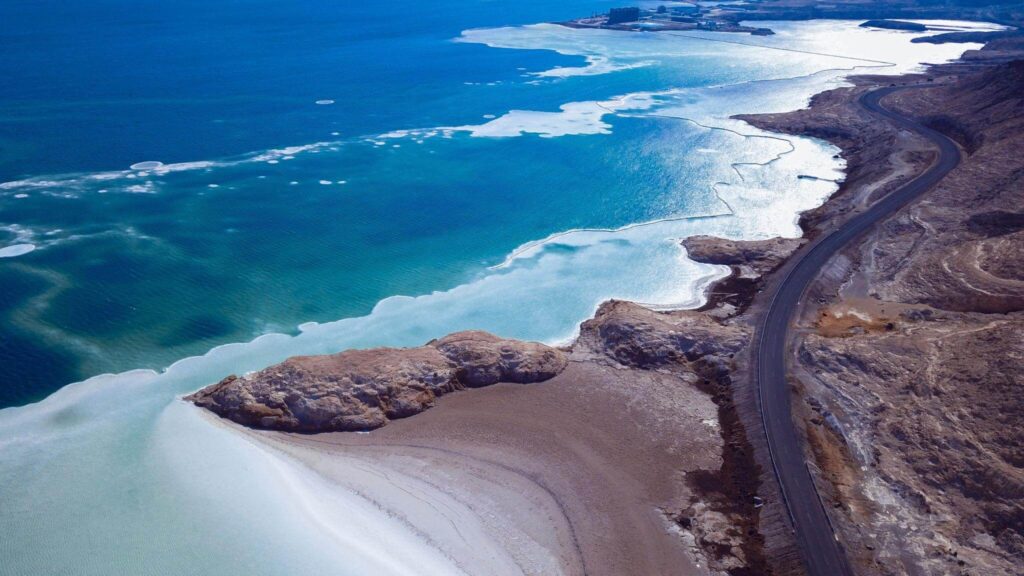
Located in central Djibouti near the western end of the Gulf of Tadjoura, Lake Assal is a spectacular saline lake surrounded by volcanic landscapes, black lava fields, and shimmering white salt flats. The lake’s dramatic scenery and intensely salty waters make it one of the most extraordinary natural attractions in East Africa and among the country’s most visited landmarks.
Lake Assal lies approximately 508 ft (155 m) below sea level, making it the lowest point on land in Africa and the third-lowest point on Earth. Its extreme salinity, harsh desert climate, and striking geological setting have made the lake an important site for scientific study, tourism, and traditional salt harvesting for centuries.
Sea of Galilee, Israel
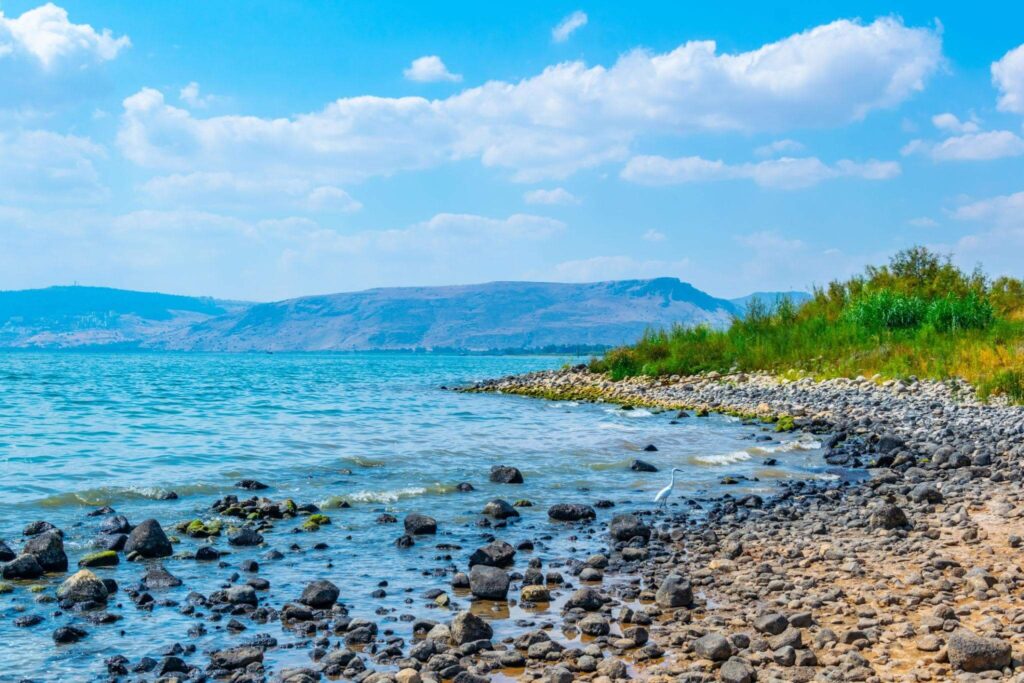
The Sea of Galilee, also known as Lake Kinneret, is one of Israel’s most important natural and historical landmarks. Surrounded by rolling hills and ancient towns, the freshwater lake is deeply significant in Christian history and is closely associated with the life and teachings of Jesus Christ. According to the New Testament, many of Jesus’ miracles and sermons took place along its shores, making it a major pilgrimage destination for visitors from around the world.
With a surface elevation of approximately 685 ft (209 m) below sea level, the Sea of Galilee is considered the second-lowest place on Earth and the world’s lowest freshwater lake. Beyond its religious importance, it also serves as a vital water source for Israel and supports tourism, fishing, and agriculture throughout the surrounding region.
The Dead Sea, Jordan/Israel
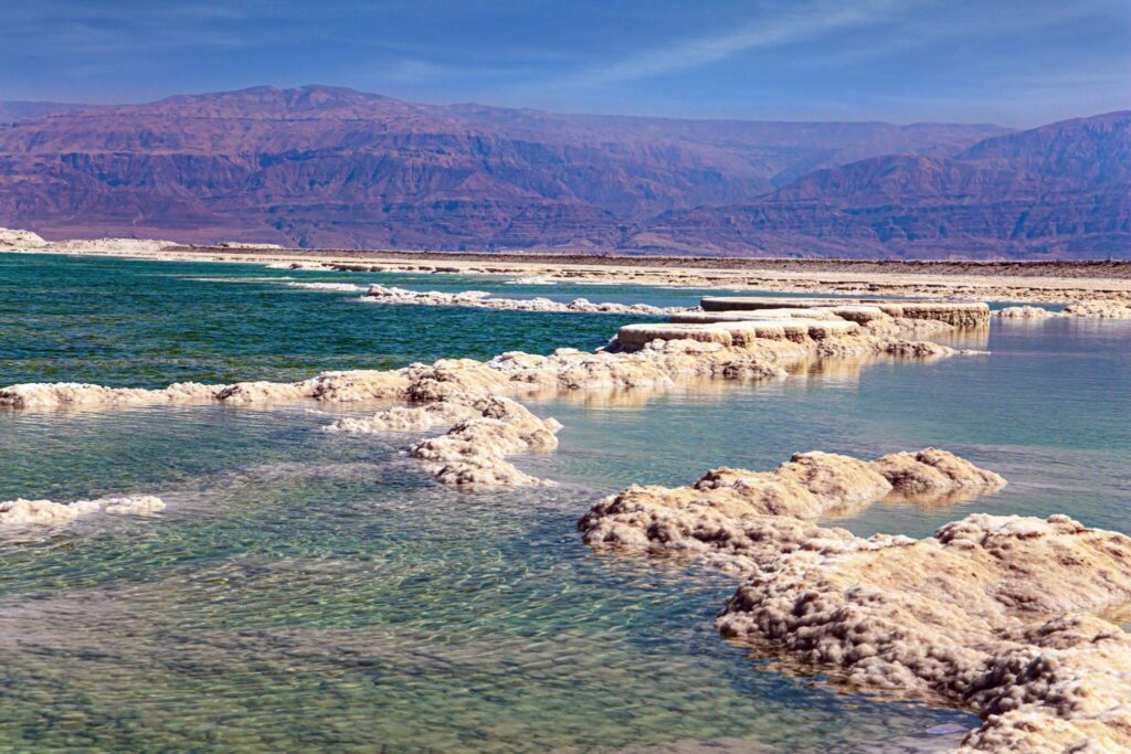
Bordered by Jordan and Israel, the Dead Sea is one of the world’s most extraordinary natural wonders and among the Middle East’s most famous tourist destinations. Known for its intensely salty waters and mineral-rich mud, the lake allows visitors to float effortlessly on its surface. Surrounded by dramatic desert landscapes and rugged cliffs, the Dead Sea has attracted travelers, historians, and wellness seekers for centuries.
At approximately 1,358 ft (414 m) below sea level, the Dead Sea holds the distinction of having the lowest land-based elevation on Earth. Its extreme salinity prevents most aquatic life from surviving, which is how the lake earned its name. Beyond its unique natural properties, the region is also renowned for its historical significance, therapeutic resorts, and breathtaking desert scenery.
Byrd Glacier, Antarctica
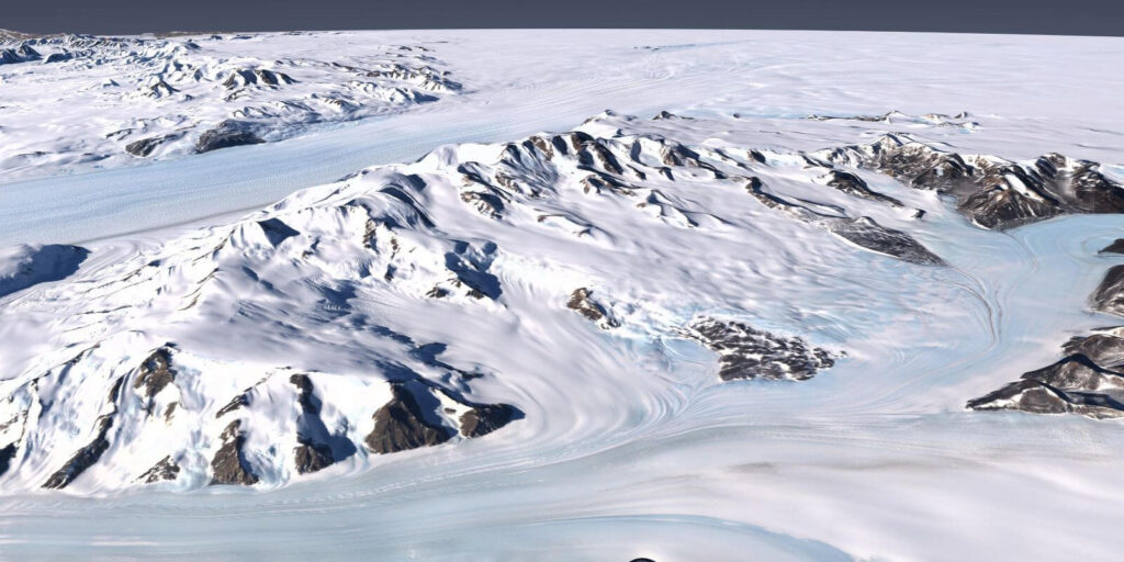
Deep within Antarctica’s frozen wilderness, Byrd Glacier is one of the continent’s largest and most dramatic glaciers. Stretching from the East Antarctic Ice Sheet toward the Ross Ice Shelf, the glacier carves through rugged mountain ranges and transports enormous volumes of ice across the polar landscape. Its remote location and immense scale make it one of the most fascinating glacial systems on Earth.
Beneath the thick ice covering the region lies a valley that reaches an astonishing 9,121 ft (2,780 m) below sea level. Assuming ice itself is not counted as water, this hidden subglacial basin ranks among the deepest known land depressions on the planet. The area remains buried beneath massive layers of Antarctic ice, revealing how much of Earth’s most extreme geography is concealed beneath the frozen surface.
Denman Glacier, Antarctica
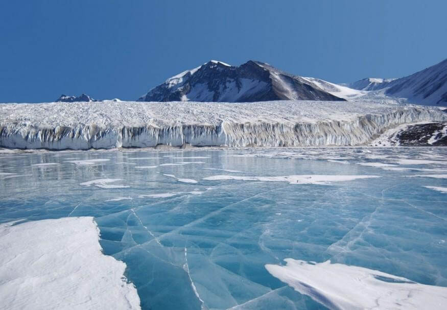
Hidden beneath the vast ice sheets of East Antarctica, Denman Glacier is home to one of the most extreme geological features on Earth. The glacier flows through a massive icy valley surrounded by the frozen wilderness of the Antarctic continent, where towering ice formations and powerful glacial movement have shaped the landscape over millions of years.
Beneath the glacier lies the deepest known natural land canyon on Earth, with bedrock plunging approximately 11,500 ft (3,500 m) below sea level. Unlike ocean trenches filled with water, this enormous depression is buried under thick layers of ice, making it one of the planet’s most extraordinary hidden landforms. Scientists continue to study the glacier closely because of its importance to climate research and rising sea-level projections.
Final Thoughts
The world’s most fascinating places below sea level reveal an entirely different side of Earth’s geography. From scorching desert basins and ancient salt lakes to hidden Antarctic canyons buried beneath miles of ice, these remarkable landscapes are far more than simple depressions in the land — they are regions shaped by powerful geological forces, extreme climates, and centuries of human adaptation.
Some, like the Dead Sea and Death Valley, have become world-famous travel destinations, while others remain remote and rarely explored. Together, they highlight the incredible diversity of our planet and remind us that some of Earth’s most extraordinary natural wonders are found not above the mountains, but deep below sea level.
